Update on classification results

Time has flown and I’m into my final two weeks at the CIAT office. At the start of the week I had a discussion with the Terra-I team about the challenges and timeline for the national level cocoa classification, given my limited timeframe remaining. I’m hoping to get some cocoa probability maps from them this week.

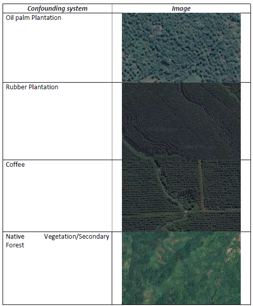
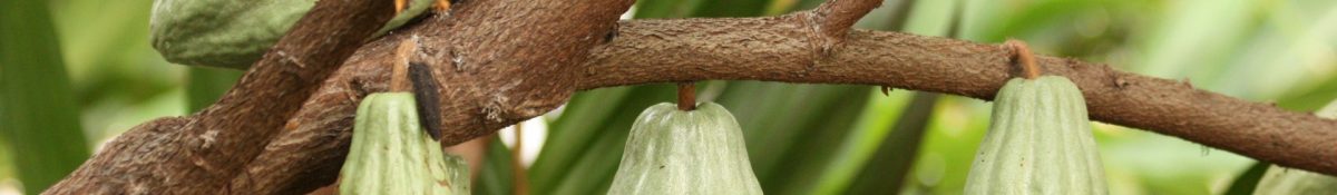
From the trial runs carried out for the Lampung province, it has been found that the automatic classification system is working quite well at the lower probability end of the cocoa classification. However, at the other end of the scale (positive identification of cocoa), rubber and coffee plantations seem to be the most problematic confounding systems in this region. Coffee and rubber was identified as one of the four most likely confounding systems prior to starting the system training exercise. See figure below of the image interpretation key of the four confounding systems used in the supervised classification.

Continue reading “Update on classification results”

Preliminary cocoa classification results

A trial run for automatic classification of cocoa in the landscape was performed for the Lampung province last week by the Terra-I team. This was following a number of supervised classifications of cocoa which were used to train the system for automatic classification.

The output provided a better understanding of how the system is currently working and how it can be refined. I have a better idea of how the final output is likely to look for my research objective of estimating the spatial distribution and areas. The system is currently set up to identify cocoa within ranges of confidence, see output image below for Lampung with the areas in blue being the least likely to have cocoa and red being the most likely.

Continue reading “Preliminary cocoa classification results”

Estimating aboveground carbon stock in forests: Remote sensing

Following on from the last few blog posts, a third technique for estimating aboveground carbon stocks is through remote sensing. Remote sensing has relevance for my project since we are using it to identify cocoa farm typologies at a large (national) scale and I will indirectly use it to classify the carbon stock of those typologies.

Remote sensing and satellite imagery techniques can cover large ages and can be used for landscape classification when combined with secondary spatial information. Broad forest types at the landscape level and even tree dimensions at the plot level can be estimated which can then be converted into biomass using statistical relationships (Brown, 1997; Chave et al., 2005; Saatchi et al., 2011). Remote sensing techniques can broadly be grouped into categories of optical sensing, high-resolution satellite imagery, microwave or radar, and LiDAR. Continue reading “Estimating aboveground carbon stock in forests: Remote sensing”

Challenges of remote sensing for mapping plantations

The past week I was helping to compile information and guidance for the Terra-I team to allow them to start mapping the cocoa farms from the polygons they have been given. One of the biggest challenges they will face is distinguishing tree plantations from other vegetation such as secondary forests with a high degree of accuracy. This was backed up by my review of the available literature on this topic on Tuesday.

Spectral confusion (reflectance from vegetation) with native vegetation is a well-known challenge in agroforestry and tree crop systems, particularly in mapping cocoa, shade coffee, oil palm, and evergreen rubber tree plantations. Tree crops are grown using full sun or low shade methods are less likely to be misclassified than when they are grown in densely-shaded agroforest.

Cocoa cultivation systems (source: Jacobi et al., 2013) Continue reading “Challenges of remote sensing for mapping plantations”