A trial run for automatic classification of cocoa in the landscape was performed for the Lampung province last week by the Terra-I team. This was following a number of supervised classifications of cocoa which were used to train the system for automatic classification.
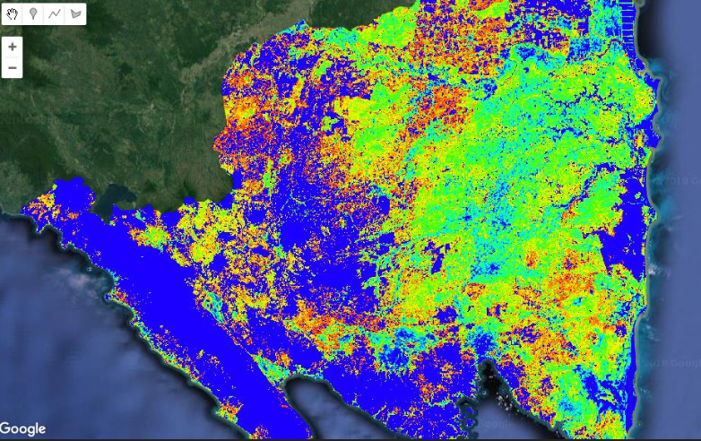
The output provided a better understanding of how the system is currently working and how it can be refined. I have a better idea of how the final output is likely to look for my research objective of estimating the spatial distribution and areas. The system is currently set up to identify cocoa within ranges of confidence, see output image below for Lampung with the areas in blue being the least likely to have cocoa and red being the most likely.
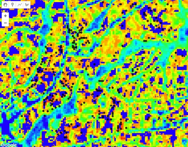
There were some known cocoa farm GPS locations within areas mapped as lowest probability for cocoa which will be addressed in the next run (possibly more training points are needed), along with training the system to identify cities, lakes, etc. as areas of low probability for cocoa. See image below where there are some positive and some negative classifications for the known cocoa locations (in black).
Since the trial run took about two days to analyse, it is likely that the next run will be limited to Lampung again to make sure the refinements are working before applying over the entire country. There is uncertainty how long a nation-wide run might take. The other research objective is to train the system identify cocoa typologies (i.e. low to high shade management systems) so I will have to wait and see how things progress over the next while.