Key research findings and final reflections

Following a busy few weeks of write-up and last-minute incorporation of results, my MSc thesis has been submitted! Though challenging at times, it has been an enjoyable and rewarding experience overall. I’m grateful that I got the chance to carry out my placement in Vietnam, and my supervisors in CIAT and NUI Galway were supportive and encouraging throughout.

Have a look at the results section for an overview of the key research findings. Continue reading “Key research findings and final reflections”

The importance of definitions in deforestation assessments

How forested land is defined in deforestation assessments has always been a “contentious” issue in Indonesia as the article below from Mongabay describes. International organisations such as the FAO define forest as “land spanning more than 0.5 hectares with trees higher than 5 meters and a canopy cover of more than 10 percent, or trees able to reach these thresholds in situ” (FAO, 2012a). Continue reading “The importance of definitions in deforestation assessments”

Final presentation of results to CIAT

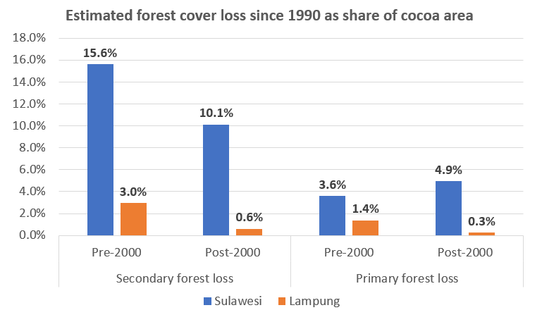
This week I got data on cocoa farm areas and primary and secondary deforestation figures for Sulawesi and Lampung and presented a quick assessment of these results to CIAT at a lunchtime presentation yesterday. I will spend more time over the coming days examining the data but this quick assessment (see figure below) showed that about 35% of cocoa areas in Sulawesi were located on areas that were deforested since the 1990s, compared with only about 5% of cocoa areas in Lampung. There may be many reasons for this, which I hope to explore a bit more once I have the Sulawesi data broken down into the four provinces.

Continue reading “Final presentation of results to CIAT”

Heatwaves and wildfires: a new reality for Ireland’s forests

The recent spate of wildfires in Ireland following the heatwave are a reminder of how the climate and weather is changing and how it is affecting efforts to protect forests in Ireland. Even the best laid plans to protect forested areas can be brought down in mere days by uncontrollable wildfires. Prolonged hot and dry spells were once a rarity in Ireland but are becoming more frequent and with it come more favorable conditions for wildfires.

The biggest of the recent wildfires was in the Slieve Bloom mountains on the Laois/Offaly border. It had a front of over 4.5 miles and burned for more than a week. Although the full extent of the damage is not yet clear there are estimates of 180 hectares destroyed from this fire alone, with loss of habitats and release of carbon dioxide into the atmosphere slightly more difficult to quantity.

Challenges and opportunities for zero deforestation commodities

Recently I came across an interesting discussion item from CIFOR (Center for International Forestry Research) entitled “Are deforestation-free commodities too good to be true?” which nicely summarises the challenges and opportunities for commodities. Continue reading “Challenges and opportunities for zero deforestation commodities”

Estimating aboveground carbon stock in forests: Biome approach

The aim of this post is to introduce the various methods that have evolved to measure forest carbon stocks and focus on one of the most commonly used high level methods. Subsequent posts will focus on other methods.

Importance of measurement

Forests are of global importance because of their biodiversity and the carbon they sequester. A reservoir or system which has the capacity to accumulate or release carbon is known as a “pool” (FAO, 2016). In the context of forests it refers to the amount of carbon stored in the world’s forest ecosystem, mainly in living biomass and soil, but to a lesser extent also in dead wood and litter. Continue reading “Estimating aboveground carbon stock in forests: Biome approach”

Challenges of remote sensing for mapping plantations

The past week I was helping to compile information and guidance for the Terra-I team to allow them to start mapping the cocoa farms from the polygons they have been given. One of the biggest challenges they will face is distinguishing tree plantations from other vegetation such as secondary forests with a high degree of accuracy. This was backed up by my review of the available literature on this topic on Tuesday.

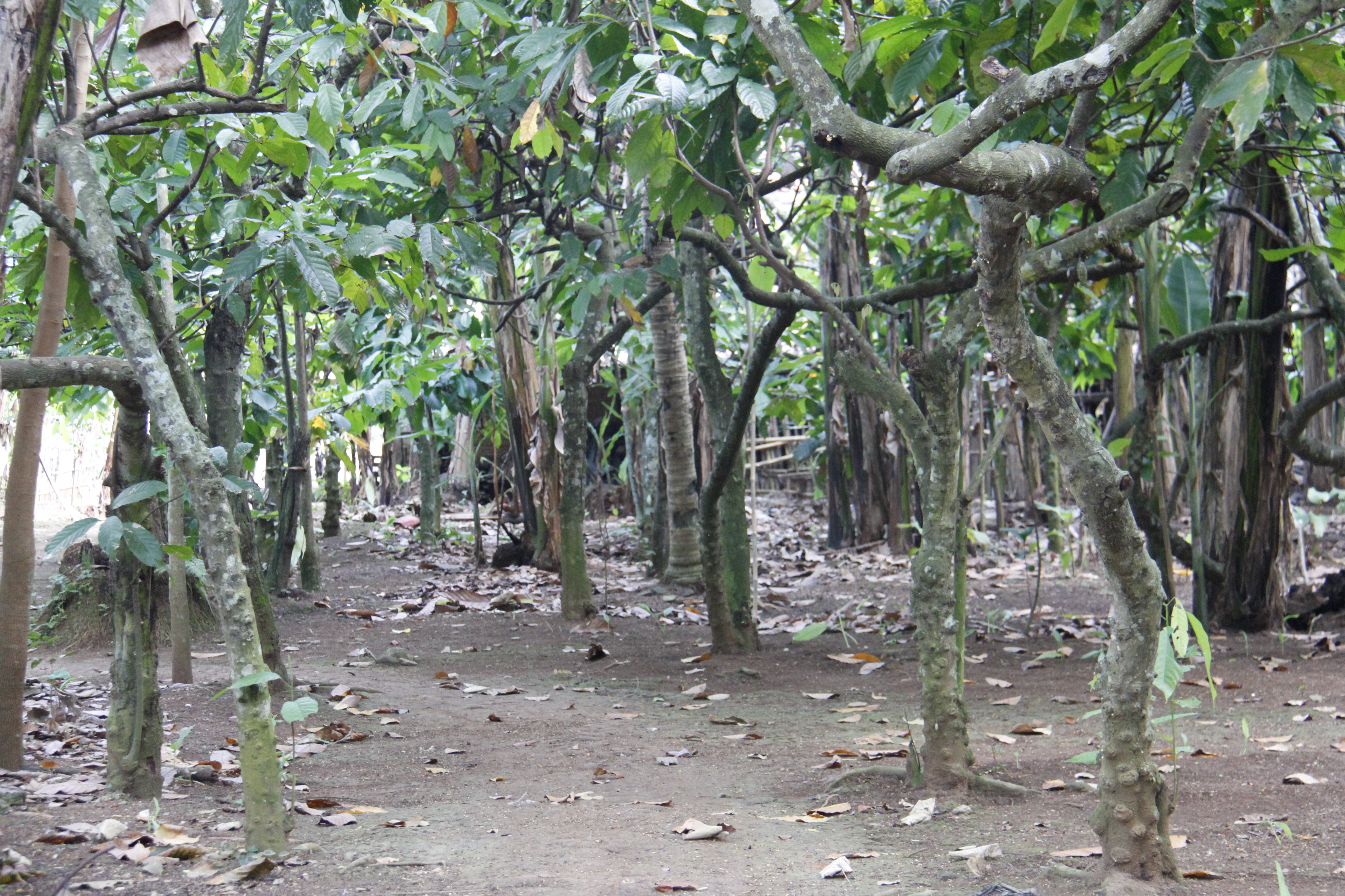
Spectral confusion (reflectance from vegetation) with native vegetation is a well-known challenge in agroforestry and tree crop systems, particularly in mapping cocoa, shade coffee, oil palm, and evergreen rubber tree plantations. Tree crops are grown using full sun or low shade methods are less likely to be misclassified than when they are grown in densely-shaded agroforest.

Cocoa cultivation systems (source: Jacobi et al., 2013) Continue reading “Challenges of remote sensing for mapping plantations”

Terra-I and land-use change detection

Terra-I detects and monitors land cover change resulting from human activities. It was developed in cooperation with CIAT to provide decision-makers and national and local authorities near real time updates of vegetation loss and deforestation.

Terra-I will be a powerful tool for this research project. My ability to estimate the carbon impact at a national level is largely dependent on the Terra-I team being able to locate and estimate the sizes of cocoa plantations. The exercise will require a visual inspection of satellite imagery to confirm what a typical cocoa farm signature should look like. This information will then be able to be fed back into the system in order to replicate on a large scale.

Below is a short time-lapse video of Terra-I detecting land-use change and deforestation (shown in red) in the Amazon.