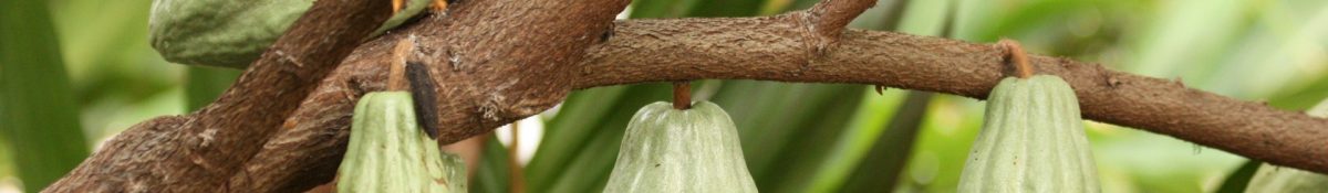
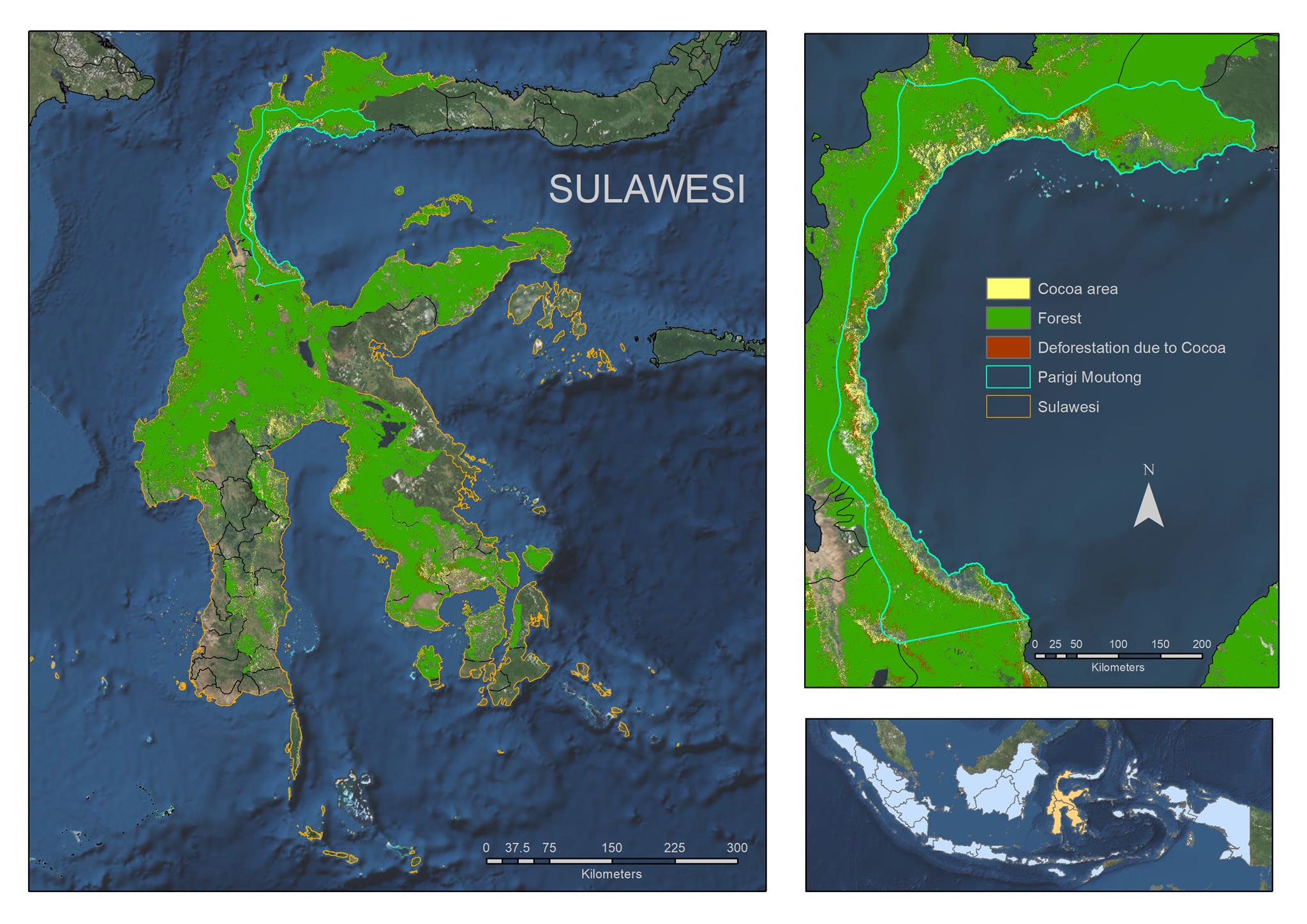
A map showing the results of the Terra-i classification for Sulawesi is shown below. The 2016 cocoa areas are mapped in yellow, the 1990-2016 forested land is mapped in green and the cocoa-related deforestation is shown in red.
 A brief summary of the key research findings are as follows:
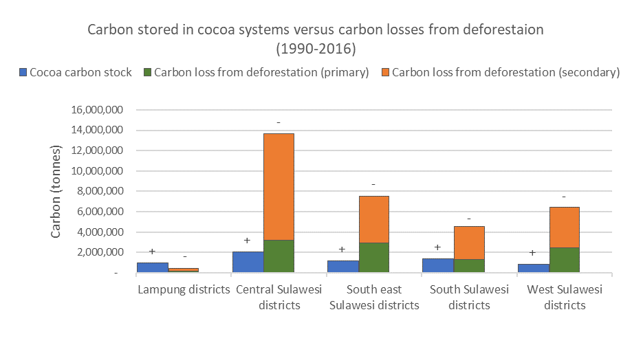
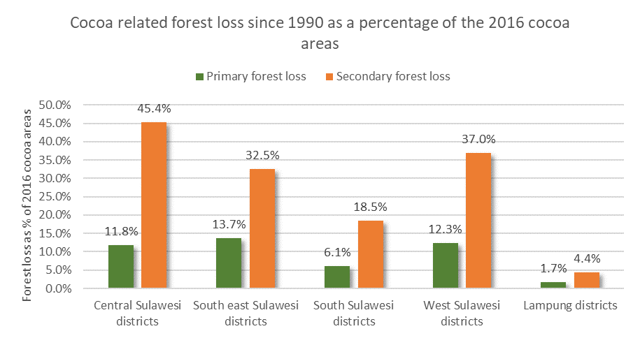
- In the Lampung and Sulawesi provinces, it was found that on average 42% of the identified 2016 cocoa areas had been deforested since 1990. It was assumed that this was cocoa-related deforestation. Central Sulawesi had the largest share of cocoa deforestation compared with the total cocoa areas and Lampung had the smallest.
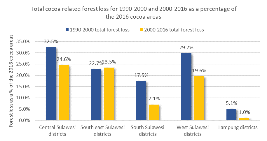
- A decline in the rate of cocoa-related deforestation was observed after 2000 compared with 1990 to 2000, in line with national deforestation trends.
- Carbon stock per hectare is greater in Lampung compared with Central, South, Southeast and West Sulawesi due to a greater proportion of agroforestry and high-shade cocoa systems in Lampung.
- Estimates suggest total carbon lost from cocoa-related deforestation is approximately five time greater than the total cocoa carbon stock. Further expansion of cocoa into forested areas will have the biggest impact in terms of carbon loss and therefore should be avoided where possible. Instead cocoa expansion should focus on establishment on fallow or degraded land where there will be a net gain in carbon stock.
- In addition to avoiding deforestation, another mitigation option to contribute to Indonesia’s NDCs is to increase the level of shade across Sulawesi cocoa farms, which could increase carbon stock by up to 35% in a best-case scenario and contribute to Indonesia’s Nationally Determined Contribution targets.