Key research findings and final reflections

Following a busy few weeks of write-up and last-minute incorporation of results, my MSc thesis has been submitted! Though challenging at times, it has been an enjoyable and rewarding experience overall. I’m grateful that I got the chance to carry out my placement in Vietnam, and my supervisors in CIAT and NUI Galway were supportive and encouraging throughout.

Have a look at the results section for an overview of the key research findings. Continue reading “Key research findings and final reflections”

The importance of definitions in deforestation assessments

How forested land is defined in deforestation assessments has always been a “contentious” issue in Indonesia as the article below from Mongabay describes. International organisations such as the FAO define forest as “land spanning more than 0.5 hectares with trees higher than 5 meters and a canopy cover of more than 10 percent, or trees able to reach these thresholds in situ” (FAO, 2012a). Continue reading “The importance of definitions in deforestation assessments”

Verification of remote sensing data

Verification of remote sensing data is essential to calibrate methods and ensure acceptable levels of accuracy. For this research project the Terra-I remote sensing data was validated using government statistics on cocoa production and knowledge of CIAT colleagues. However field verification is normally the preferred and most accurate (though generally most expensive) validation technique.

The below link is to an informative blog post about a field verification exercise carried out for Terra-I data in the Peruvian Amazon. The data to be validated included over 25,000 ha of land cover loss from between 2004 and April 2015. The verification exercise used Terra-I data for 2013, 2014 and 2015 to define 65 sampling points and then using three buffer zones, randomly selected pixels for field validation.

http://www.terra-i.org/news/news/Validating-Terra-i-in-the-Peruvian-Amazon.html

Final presentation of results to CIAT

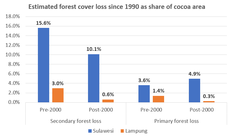
This week I got data on cocoa farm areas and primary and secondary deforestation figures for Sulawesi and Lampung and presented a quick assessment of these results to CIAT at a lunchtime presentation yesterday. I will spend more time over the coming days examining the data but this quick assessment (see figure below) showed that about 35% of cocoa areas in Sulawesi were located on areas that were deforested since the 1990s, compared with only about 5% of cocoa areas in Lampung. There may be many reasons for this, which I hope to explore a bit more once I have the Sulawesi data broken down into the four provinces.

Continue reading “Final presentation of results to CIAT”