It is DATA time!
Hello there,
Another Friday that went by, another week that went really fast. Time flying is a good sign!
This week I have been working on the surveys related to the Cauca CSV. Before analysing the data there are a few steps to have in mind.
Firstly, I did a comparison between 4 CSV surveys to see the difference between them. Those 4 surveys were made at different times, the first one is considered the base-survey, then it follows the surveys did in Ghana in 2017, Tuma-La Dalia(2018, Nicaragua) and Cauca (2018, Colombia). The main objective to do this comparison was to redo a survey in English with updates questions from the last survey did in Cauca and in Spanish.
Secondly, I related the different questions from the Cauca CSV survey with the different CCAFS monitoring indicators. This relation was done to see if each indicator had questions related, and also to check if there were any questions that do not bring any relevant information.
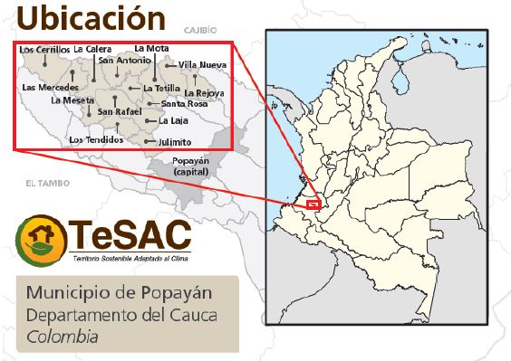
Thirdly, I started wih the overview of the raw data from Cauca CSV surveys. Cauca CSV surveys were done in 7 different locations (El Danubio, La Mota, Las Mercedes, Los Cerrillos, Los Tendidos, San Antonio and San Rafael). The following figure shows the location of the Cauca CSV sites surveyed.
The surveys have 6 different modules such as M0. Demographic, M1. Climate Shocks, M2. Climate Services, M3. Livelihood Security & Financial Services, M4. Food Security, and M5. Climate-Smart Options.
It is a long journey before analysing the data, but it is the best way to found out if there is anything that is missing or is a mistake.
I will let you know more about it,
See you next week,
Laia
References:
MORA MONTERO, A. E. 2017. Diseño de una metodología de escalamiento de las prácticas de agricultura sostenible adaptada al clima en Cauca, Colombia.