Over the past few decades, the observation of land degradation and soil health has become increasingly complex, requiring expertise and the use of sophisticated tools to generate data reports. As a result, many least developed countries face difficulties in monitoring the situation of their land degradation and soil health, as well as obtaining essential data for developing sustainable land management strategies. In order to overcome these challenges, several organizations have been developing a number of software applications and tools to serve these purposes.
During my postgraduate studies in MSc Climate Change, Agriculture, and Food Security, I delved into tools that could support my research, specifically in the context of soil health improvement in my home country, Lao PDR. However, due to the lack of available data on land degradation in the country, I had to take the initiative to generate my own data. In this pursuit, I discovered that the application “Trends.Earth” proved to be exceptional in meeting my requirements.
The mapping tool Trends.Earth, developed by Conservation International as a QGIS software plugin, serves as a valuable resource for comprehending land change dynamics, encompassing the underlying reasons and processes. As a free and open-source tool, Trends.Earth empowers users to leverage a wealth of information from various sources, ranging from globally accessible data to customized local maps. The software generates a range of outputs, including maps, graphs, and data tables, catering to diverse users who employ them for tasks such as planning and monitoring restoration efforts, as well as tracking urbanization patterns.
Notably, Trends.Earth has received recognition and endorsement from the United Nations Convention to Combat Desertification (UNCCD) as the approved methodology for monitoring the progress of frameworks established under the convention. Additionally, this approach has been widely adopted by numerous countries to monitor progress towards achieving Sustainable Development Goal 15 (SDG-15): Life on Land, particularly indicator 15.3.1, which focuses on combating desertification and land degradation.
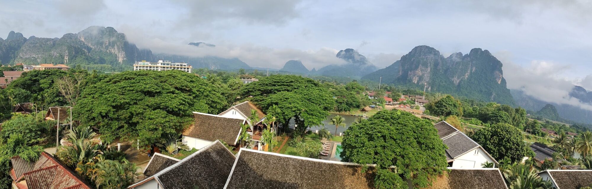
Here’s an illustrative showcase of data generated using Trends.Earth for Lao PDR.
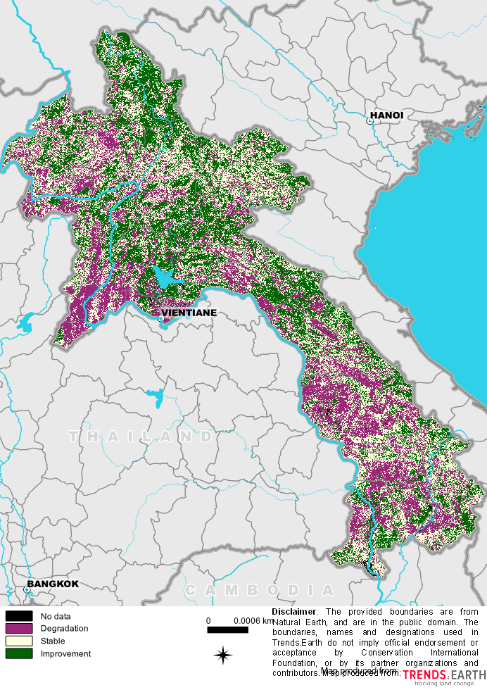
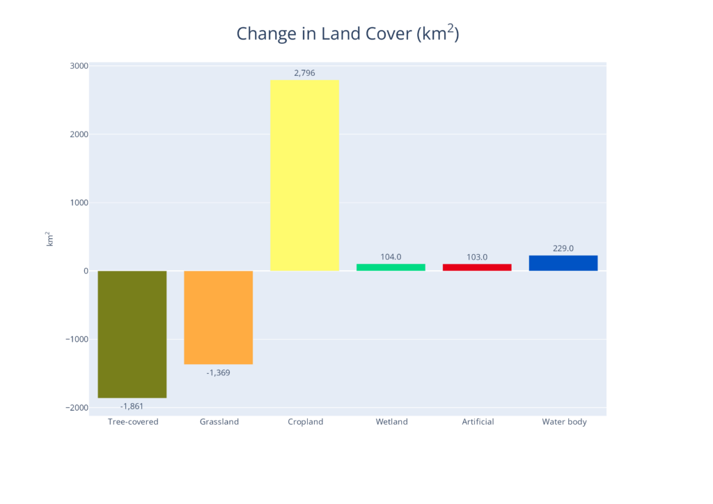
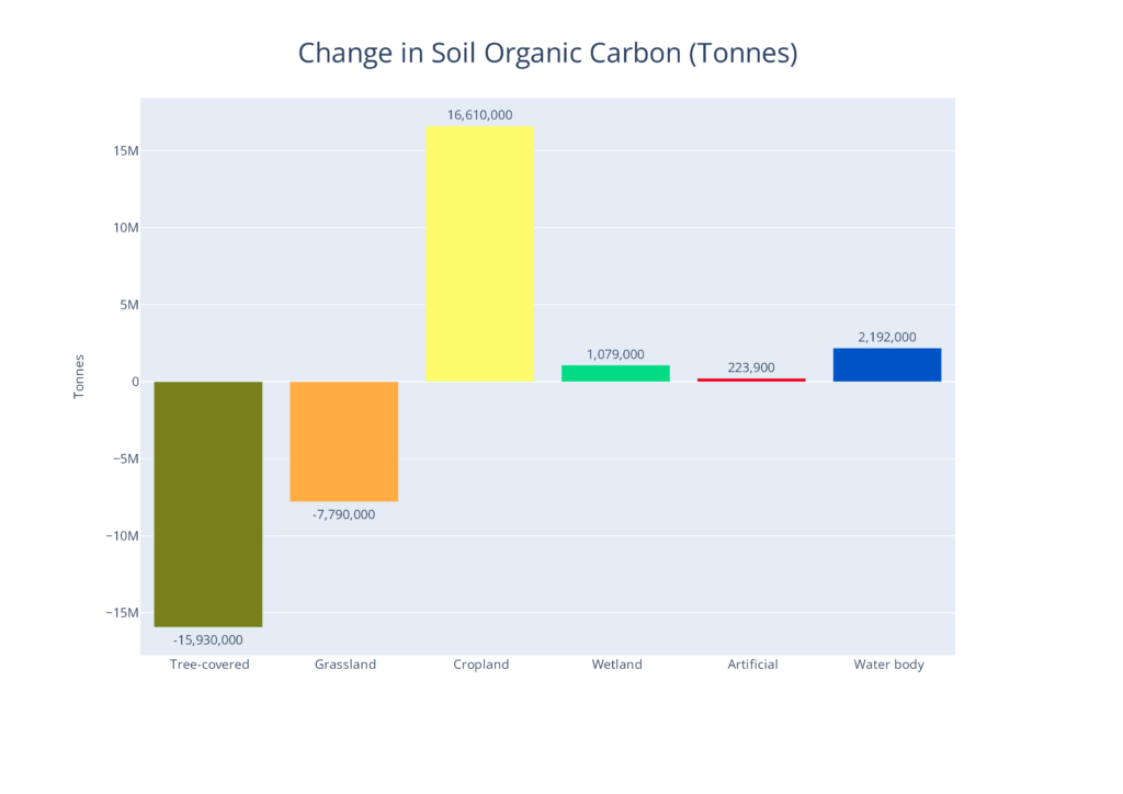
the Trends.Earth tool proves to be highly valuable for academia, policy makers, and individuals involved in monitoring land change, such as land degradation. The outputs generated by this tool cater to a wide range of purposes. However, it is important to note that users need to possess basic knowledge of the mapping software QGIS in order to effectively utilize this plugin.
Please visit the tool website for more detail and guidance